
The 3D Forward Model
Model description
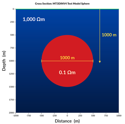
For MT3DINV4, the forward model is a sphere in a half-space. This geometry was chosen because a general analytical solution exists for any source-receiver configuration — including magnetotellurics — from Vallée and Moussaoui (2023) (DOI: 10.1080/08123985.2022.2162382), providing a rigorous benchmark against which all numerical results can be compared.
Receiver locations
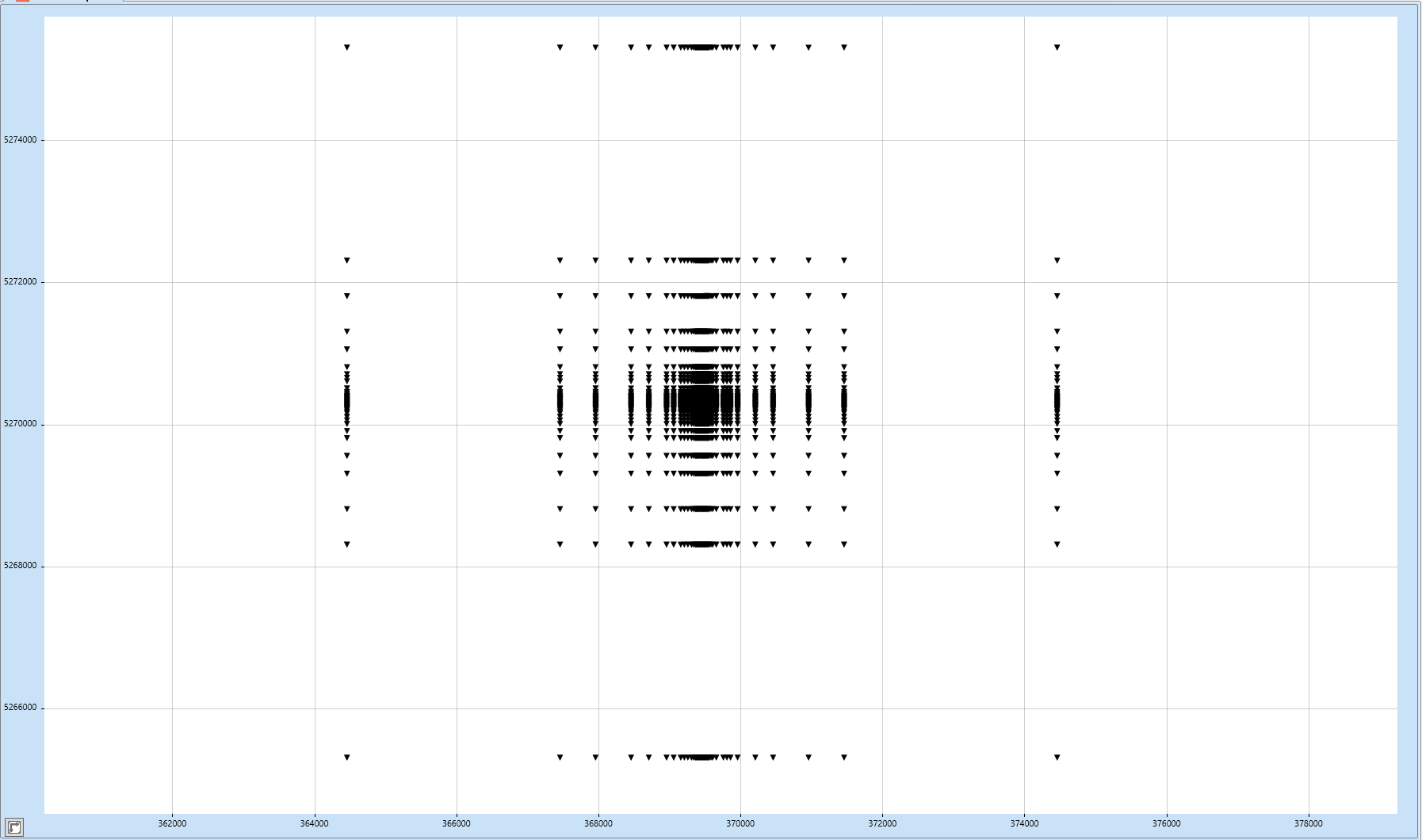
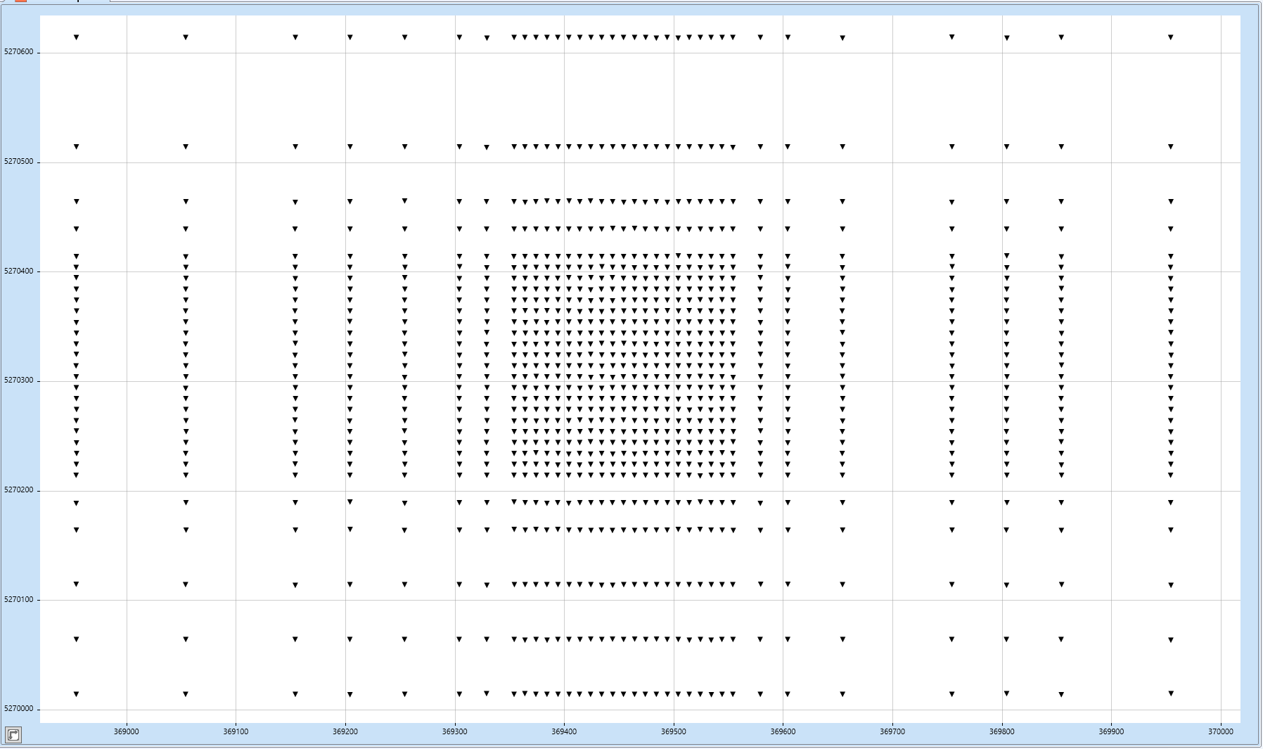
Preferably, responses are to be computed at 2,025 locations defined by a 45 × 45 grid. All positions are in metres relative to the geographic reference point defined below.
−5000 −2000 −1500 −1000 −750 −500 −400 −300 −250 −200 −150 −125 −100 −90 −80 −70 −60 −50 −40 −30 −20 −10 0 10 20 30 40 50 60 70 80 90 100 125 150 200 250 300 400 500 750 1000 1500 2000 5000
−5000 −2000 −1500 −1000 −750 −500 −400 −300 −250 −200 −150 −125 −100 −90 −80 −70 −60 −50 −40 −30 −20 −10 0 10 20 30 40 50 60 70 80 90 100 125 150 200 250 300 400 500 750 1000 1500 2000 5000
Best would be sampling along an E-W profile from (-5000,0) to (5000,0).
Geographic reference point (0, 0)
The origin of the site grid corresponds to the location of the Alexander Murray Building (home of Earth Sciences), Memorial University of Newfoundland. Coordinate conversion uses WGS84.
| Latitude | 47.5731° N |
| Longitude | 52.7358° W |
| UTM Zone | 22N |
| Easting | 369,454 m E |
| Northing | 5,270,314 m N |
| Datum | WGS84 |
Submitting your results
Responses are to be submitted in EDI format. Please include the following information in your submission email:
Type of code used (FD, FE, integral equation, etc.)
Mesh dimensions
Computing time
Hardware details (CPU speed, memory, cluster specification)
Sphere source code
The Fortran and Python Windows source codes and executables for the MTSphere program computing the magnetotelluric response of a sphere in a layered earth are now available on GitHub here.
All requests or comments about the forward code should be addressed to mvallee@geodatasolutions.ca
Discussion — Forward Model
Questions or comments? Sign in with GitHub to join the discussion.